Lesson 11: The World at Night
Upper Elementary World Geography
Review and Warm-up
Remember the climate map from Lesson 6? The colors tell us about the land: blue for oceans, white for ice and snow, brown for deserts, and green for temperate areas where most plants grow.
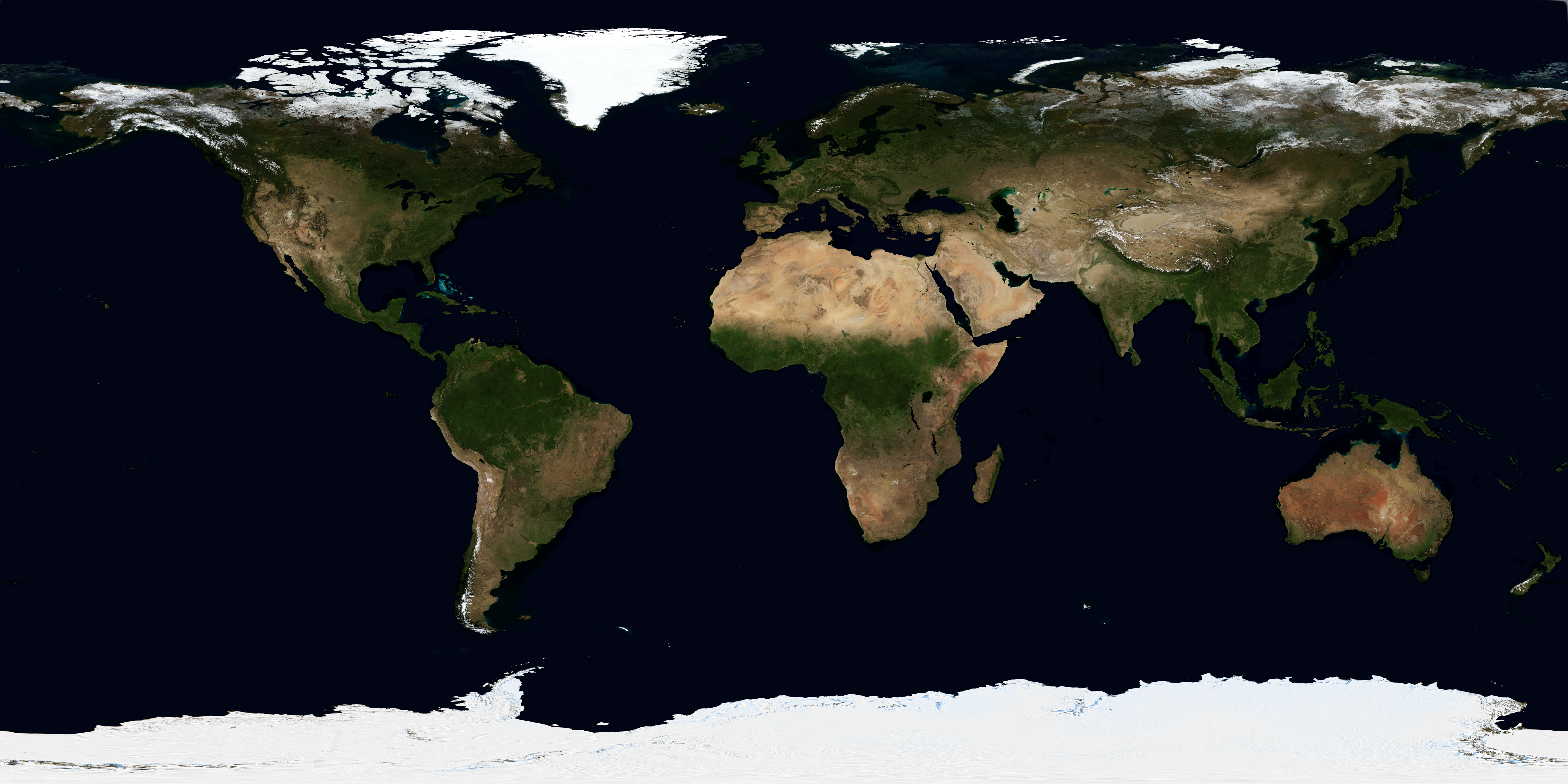
Can you identify the six largest countries on this satellite image?
The World At Night
This NASA satellite composite shows what Earth looks like at night. It was made by combining many satellite images to show the night side everywhere at once.
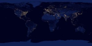
The lights show where people live and use electricity. About 90% of the world's population has access to electricity — but 10% still does not. So this map doesn't show all people, but it does reveal the most populated areas and busiest cities.
Let's look at some interesting patterns on this map.
Zooming In
Let's compare the daytime and nighttime views of different regions:
North America
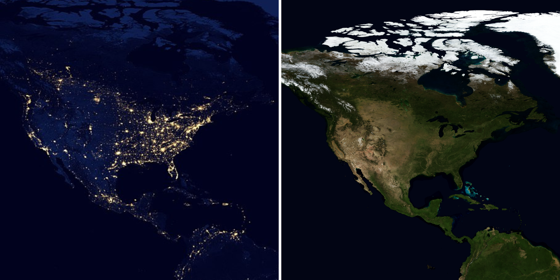
Notice how the brightest areas overlap with the green (temperate) zones on the daytime map. The eastern half of North America is much more populated than the western half — this is connected to water access, trade routes, and where people first settled.
India
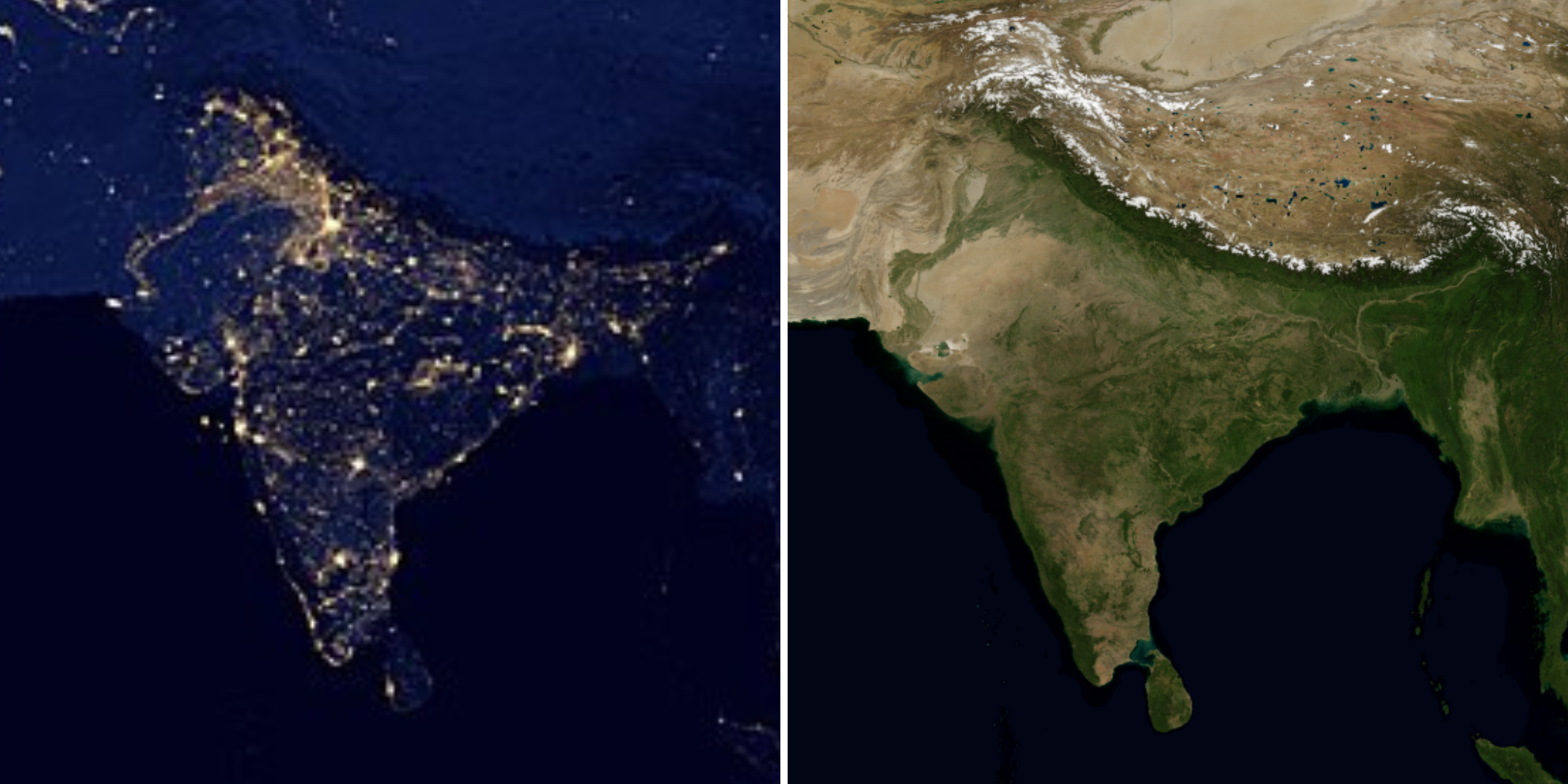
India's high population density is clearly visible in the nighttime image.
China
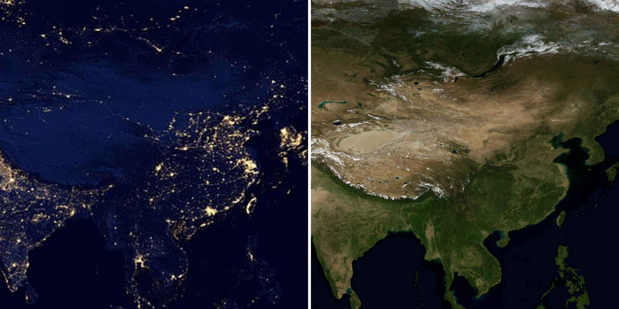
Notice that the eastern part of China is much brighter than the western part. Geography — mountains, deserts, and climate — shapes where people can live.
Another Country to Identify
Egypt and the Nile River
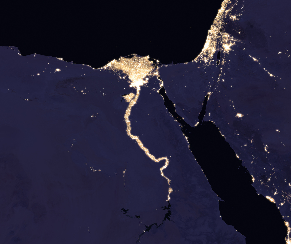
Can you see the flower-like shape with a stem and roots? That's the Nile River flowing through the Sahara Desert.
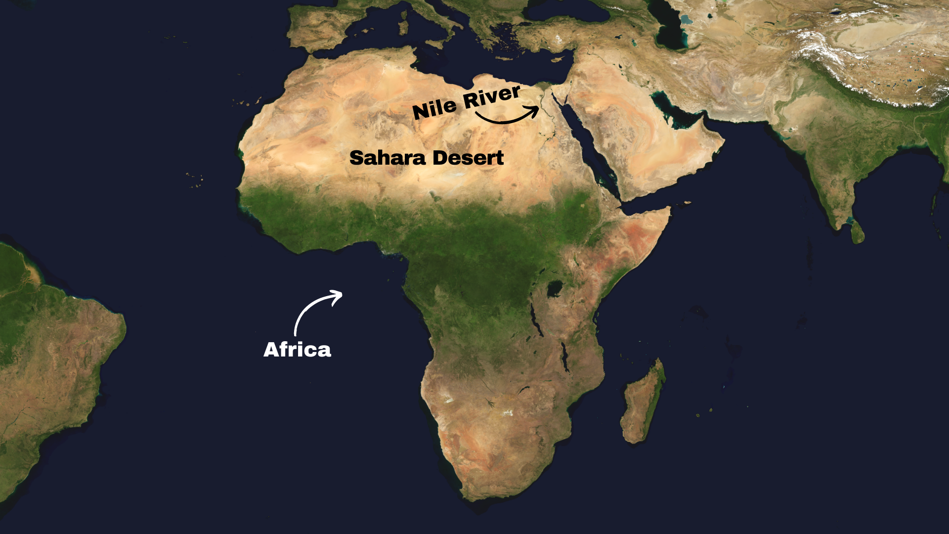
The Nile River creates a green strip of land through the desert, making agriculture and settlement possible. Cairo and Alexandria — Egypt's largest cities — sit at the northern mouth of the Nile where the lights are most concentrated.
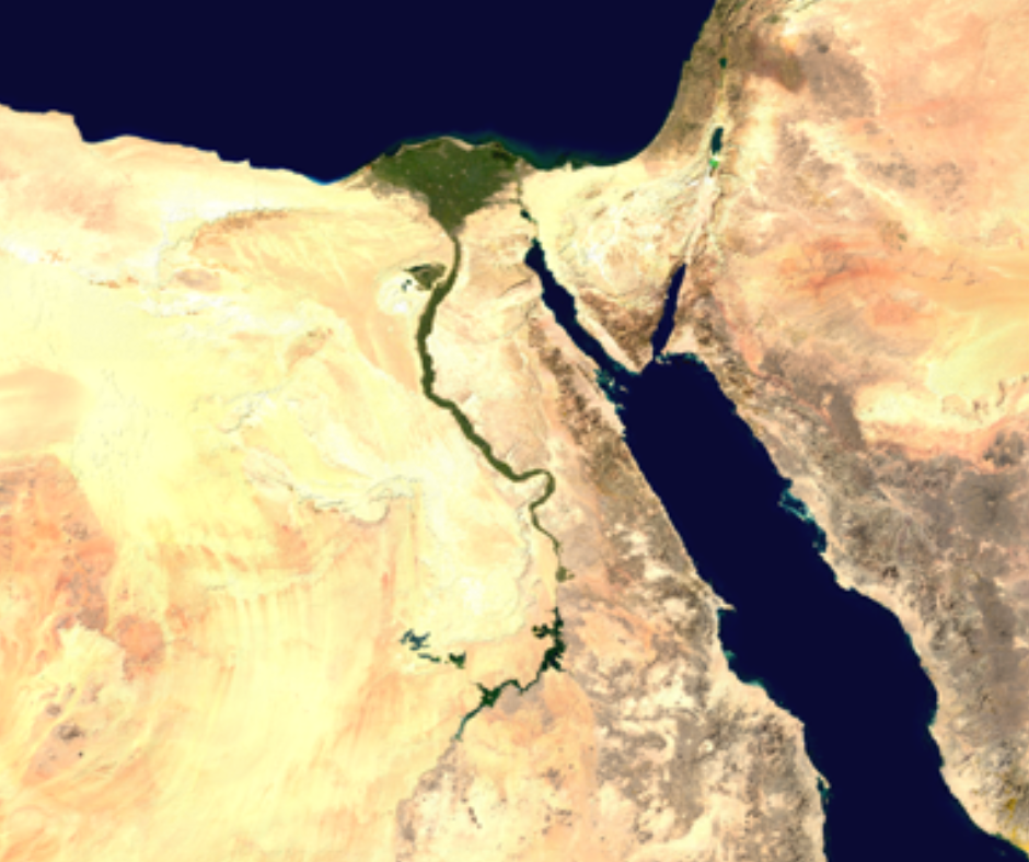
This is a perfect example of how geography determines where people live: the river enables population concentration in an otherwise uninhabitable desert.
Northern Italy
Continuing from our Lesson 10 extension, let's look at Italy at night:
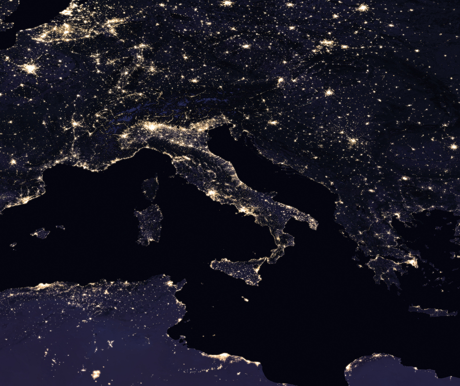
You can clearly see Italy's boot shape! Now look at northern Italy more closely:
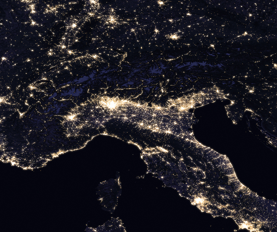
There's a bright curved line of lights with a dark area above it. Let's compare with the daytime view:
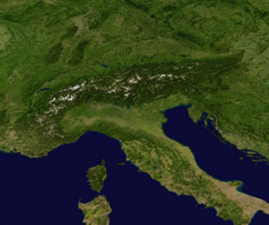
The dark area is the Alps — snowy mountain peaks where few people live. The bright area below is the Po Valley, a river basin with high population density. Geography determines settlement: mountains are difficult to inhabit, while valleys with rivers attract people.
Wrap-Up and Practice
Now it's your turn to explore! Visit Google Earth at Night and find your own location. Create a slideshow with screenshots of interesting patterns you discover.
Open Google Earth at Night